Lessons
Day 1
1Pre-Show Banter
07:02 29:00 am - Introduction: Why Lightroom®?
13:23 3The Lightroom Library Catalog
16:42 4Staying Organized
15:00 5Backing Up Your Library
11:12 6Importing Your Photos
34:20 7Preferences & Settings
28:57Settings Q&A
10:49 9Reorganizing Files and Folders
33:25 10Using Views and Labels to Evaluate Photos
45:00 11Filtering and Stacking Photos
13:37 12Assigning and Managing Keywords
31:42 13Keywording Q&A
12:43 14The Metadata Panel
14:38 15Searching for Photos
20:54 16Creating a Collection
15:25Day 2
17Day 2 Pre-Show Banter
09:09 18The Map Module: Assigning Locations
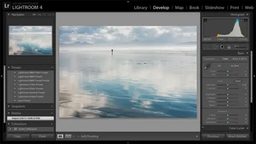
43:33 19The Develop Module
11:37 20Fixing Your Photos: Histograms and Cropping
22:02 21Fixing Your Photos: Spot Removal Tool
33:25 2211:30 am - Upgrading to Lightroom® 4
12:14 2311:45 am - Basic Developing in Lightroom® 3 & 4
21:29 24Basic Developing Part 2
19:43 25Color Adjustments
23:36 26Tone Curve Panel
18:59 27Making Subtle Adjustments
13:22 28Lens Corrections
10:54 29Local Adjustments: Partial B&W
13:03 30Local Adjustments: Portrait Touch Up
26:05 31Additional Local Adjustments
09:55 32Graduated Filter
24:24 33Bonus: Day 3 Preview
01:19Day 3
34Day 3 Pre-Show Banter
12:44 35Bonus: Recap of the Develop Module
08:44 36Virtual Copies
08:58 37B&W and Creative Effects
20:50 38Noise Reduction
12:23 39Sharpening
18:33 40Sharpening for Portraits
08:46 41Syncing Changes to Multiple Photos
17:53 42Autosync
21:09 43Creating and Using Presets
15:53 4411:45 am - Lightroom® and Photoshop
22:49 45Sharing Your Work
08:42 46Exporting for Web
16:59 47Exporting for Print
26:06 48Workflow Recap
40:50 49Thanks + Credits
07:02 503:00 pm - Lightroom® 4: Publishing
20:52 513:30 pm - Lightroom® 4: Video Editing
12:38 523:45 pm - Lightroom® 4: Book Module
19:36Lesson Info
The Map Module: Assigning Locations
Let's go to the map module. So we have the magic module picker in the top right here. We'll click on math, and the map module is new and light room for. So if you have light from three, you won't have it. And it relies on Google maps. So if you don't have an Internet connection, you won't have access to anything in the map module. Now, when you open up the map module, it shows the legend here, right on top whips. I just will bring this up right now. I don't think I mentioned this yesterday as I move my mouse to the right here. That right hand panel that I had collapsed popped open on me and I didn't like that. He got in my way. I was trying to close out the legend here, and it's just annoying to me. So I want you to know that you can take control of your panels. OK, you can keep them from popping open automatically if it's not convenient for you, and this would be the left, right top or bottom. So on the right hand panel here, I'm going to right click on this sideways triangle here, an...
d I'm gonna say manual instead of auto hide and show. Okay, now it on. Lee opens and closes when I click on that triangle. Now, if you like that manual behavior, you have to do that individually on top, bottom and left. Right? Okay, So that's not specific to the map module. I just thought I'd mention that as I thought of it. Okay, so I was saying that I've got the legend here, and it's in my way. So I'm gonna go ahead and close it. I'll explain these things later. Close the map module now to move around. If if you want to see the map the legend again, you can simply go up to view show map key. So you're not hiding it forever. To move around in the map, you click and drag to zoom in there. Lots of ways to zoom in and out. So down here at the bottom, you've got a plus key. You got the minus key. You've got the slider as well. The scroll wheel on your mouse, frankly, is the one that I I use the most. And you also have the plus minus keys on your keyboard. when you're zoomed in. Then when you click and drag, you can move around to different parts of the world. Now, in the left hand panel here, I guess me Okay. In the left hand panel here I have the Navigator panel. If I've zoomed in far enough, the Navigator panel here shows me where I am in the world. I can also click and drag this square to move elsewhere, so that could be in handy thing. So let's go back to North America. Zoom back out just with a scroll wheel on my mouth. Now, what's interesting? Okay, one more thing. Um, when using back out a little bit more right now, we're seeing Google's hybrid map view. So we're seeing all of the satellite detail and the road map detail. If I actually zoomed in far enough, you'd see individual buildings. You see individual streets. I love that. But if you have a slow Internet connection, that may be too much information. So down here it the bottom. You can change the map style so I can go from hybrid, for example, to just a graphic light and dark. It's not as visually pleasing. It doesn't provide as much information, but it can load faster on slower Internet connections. So let's go back to hybrid. I'm gonna zoom out, and what's interesting to me and disorienting at first is that I don't see any pins on the map. I don't see any photos on the map, and I know that even in this class catalogue, I have some photos that have GPS latitude and longitude assigns, so they should be on the map. So what's going on is in the map module, as in all modules, the only things that the the only photos that the module is working with our photos that you see in the film strip. Now this is my Victoria photo shoot, and these photos don't have GPS latitude launch to designed, so they're not showing appear in Canada. Now I'm on Lee, looking at my Victoria shoot. What I really want to dio is go back to the library module and choose a folder of photos that has location or choose all photographs here in the catalogue section. So let's do that. Let's choose all photographs in the catalogue section. Then when we go back to the map module, you'll see that I do have some photos on the map that have GPS information assigned. So remember, in the library module, first, choose what photos you want to work with. And then the map module will allow you to work with those photos. And those photos show in the film strip here and again, the filmstrip is hiding itself on me. So I'm going to right click on that triangle. That one's actually manual. That must have been operator error again in on the Mac here. Okay, so I'm seeing photos on the map here. Now, what's the map module for? So the map module is for viewing your photos on the map for a signing location to your photos and for managing your photos based on location. So these 22 photos If I hover over this pin and I move my mouse into this preview here, this there goes, I can cycle through those photos to see those air. Very odd photos. I know, Uh, but there there there was method to that. Okay, I can cycle through the photos to see what I have assigned in in that area. So it's an easy way to get a preview of photos from a particular location. Now, I'm gonna go ahead and zoom in a little bit further on here. You can also right click on this pin and say, zoom in and it will center that pin on the map and you can continue to zoom in and you'll notice that the further I zoom in, the more detailed it will show May in terms of where these photos were taken. So if I keep going, we'll get down to the individual street level where these photos were taken. So let me actually come over to these photos up here. There we go. OK, now, the numbers in the pins indicate how Maney photos were taken in that location. So in this case, I've got two photos here. If I cycle through here, I'll see the two photos. The pens with no numbers mean that there's one photo. I'm not sure why they don't put a one in there, but that's that just means one photo. Now notice that these pins have little triangles at the bottom. That means that they were taken precisely there, or at least according to the satellite reading. If I zoom out further here with a scroll will on my mouse noticed that all of a sudden I have a clump of eight year that doesn't have that little anchor at the bottom. That means that those eight were all taken in that vicinity. And then I need to zoom in further If I want to see exactly where they were taken. Let me go ahead and soon back out here. All right? Make sure I'm not getting ahead of myself. So that's how you basically view photos on the map. Now, my digital SLR does not record GPS location, so I've got 30,000 or more photos with no GPS location, These photos that I'm showing you were taken with my IPhone. So imagine if someone pointed out to me yesterday the cheap $200 phone records, GPS location and the $1200 phone does not right our camera. Rather. But you can assign GPS location, two photos that don't have it in various ways. And the quickest way is simply to drag them to the map. So we're going to do a little bit of work assigning location, two photos that don't have the location. I'm gonna go ahead and zoom back out. Now let's go back to the library module and go to a folder of photos that does not have location assigned. So we'll use the Victoria Shoot from yesterday. So select the Victoria folder and then we'll go back to the map module and I'm not gonna zoom out and and dragged to try to get to Victoria. Let's just pretend that I don't even remember where Victoria is. Me? It's not very far from here, so that would be pretty lame. But what I'm gonna do is up here in the top, right? Is just say search map. So I'm gonna type in Victoria B C and hit enter and light room will just jump to Victoria. I'll zoom out a little bit more so you can see that. In fact, Washington is right down there, so not too far away from here. So searching will just jump you right to where you need to go Now. I could just drag this entire set of photos to the vicinity of Victoria if that's the only level of precision that I want. But I can actually drag them to individual locations within Victoria. So let's search instead of Victoria. Now let's search for, um, Bouchard Gardens, which you have to know how to spell. That's difficult for May, but its beauty. C h a r t. Here you go. Garden's. And I'll just type in Victoria just to make sure that that Google knows. Okay, Victoria did that work. All right. Okay. Maybe Victoria was a bad thing. So who? Shark gardens. Okay, now it's actually with output typing in Victoria. It's jumped May right to boo Schardt Gardens. And I'm hoping I'm pronouncing that right in Victoria and all Zoom back out now in the filmstrip, this whole first section of photos. So the first photo is selected, and if it's not, go ahead and click in the border on the first photo, and then scroll. Now, your photos. If they're in a different order, you can just drag any subset of the photos to this location. So I found the last one, though, from the garden. So I'm gonna hold the shift key down and click on the last one to select that entire row of photos or that entire subset of photos. And now where do I have to drag from to get them onto the map trick question from yesterday. The thumbnail. Exactly. If I drag from the border, I'm just breaking apart the selection here in the filmstrip. So I'm gonna do control a command. Zito, undo what I just did. I need to drag from inside one of the thumbnails, dragged them up and drop them on the map. So I now have 18 photos in the gardens there. Okay, The next set of photos here are from Hatley Castle. Now I'm hoping. Okay, so Hatley Castle is at Royal Roads University. So let's in the search bar type in Royal Roads University, because I just have more confidence that's going to come up. I could search for Hatley Castle. I'm just not sure. So Royal Roads University in Victoria? Yeah, when I dragged my photos, I gotta pop up asking me if I wanted to enable reverse geo coding. Ok, good. So the first time in light room for that? You either a sign location, GPS latitude and launched two to your photos or you import photos that already have latitude longitude on them. Light room will come up with a warning box asking you if you're okay. Enabling reverse Geo coding. So what that allows light room to do is to pass information up to Google past just GPS latitude and longitude up to google. Um, for your photos to get information for you. Now, I'm going to defer what that information is for a little bit, but you're you're giving light room permission, Teoh, go to send some information up. Um, and I'll show you even if you say OK, now I'm gonna show you in preferences how to turn that off if you change your mind once you understand what it's doing. So for now, I would just go ahead and say OK, okay, so I've searched. I found Royal Roads University. Hatley Castle is in this area. So in the filmstrip, I'm going to click on the first photo, and I'm just gonna pretend I'm not gonna be precise about which ones really are Hatley Castle. But I'll select another subset, click holding drag from inside one of the thumbnails and drop it up into that area. Now, for the sake of example, I'm gonna take this next one photo and I'm gonna drag it just to another place in the park there. So I just assigned photos to two different locations. That's all I've done. Um, so once you assigned location information, once you or get the information on the map, the question then comes up. How do you move photos? What if you drop them in the wrong place to start with? So what if he's 11 really belonged Some, You know, somewhere over here on the map. So how do you move them? If I click on the pin and I drag, it drags the map. So that's not gonna work. Now the basic answer that the answer that I would say I would use all the time, even though I'm going to show you one exception. But it's not. It's not even worth remembering, frankly, is click on the pin when you click on a pin, it selects in the filmstrip all of the photos us, you know, for that location. Okay, so click on the pin to select the photos and then from the filmstrip, click and drag from inside the thumbnails again to place them elsewhere on the map. So for the most part, you can't directly move them on the map. So you click on the pin, select from the filmstrip and move them to a different location. Now, what kind of confuses people is that there is Theo exception. Now, the exception is if you only have one photo at a particular pin. So this 11 I could not move, but this one, I could move. Now I can move it because this padlock here is unlocked. If I lock it, then I can't even move that pin Now, frankly, because the unlock and the drag on the map only works for one photo, I don't use it. I just always I leave the padlock locked. Don't pay any attention to that. And I just always use the technique. Click on the pen, select from the filmstrip and move. It's just a limitation. Um, that, as I understand it is just the light room and Google talking to each other that that makes that a little bit a little bit more complicated. Okay. All right. Let me, uh, we have a number of questions. Good take. Let's do that. So Jim Kendall asks, Is there any information available at the file level when you're in the library mode? That shows which of your photographs have the GPS in which don't great question. So regardless of whether you're in the library module or you're here in the filmstrip, you'll see a new badge. This badge means that you have GPS information to sign. So it could be a handy way, for example, from the library module to jump to those photos on the map. So here in the library module and grij grid view if I click on that GPS badge, it jumped me to that place on the map. So very handy way to get there. So thank you for reminding me to mention that A question from Sam in Loveland, Colorado. Do map locations assigned and let on four. Follow the photos when they're going to say flicker. Yes, they dio Yeah co, Yeah, good question in the audience. Can you shut that off when their ex? Yes, yes, we'll see when we get to exporting and sharing your photos that you have complete control over whether that location information goes along. Of course, in many situations that may be sensitive. You know you don't want that information to go, so you'll have control. And then we have a question from Big L and big D two. Does Matt work with Hold on. Does map work with keywords like location hierarchy? Um, and vice versa. So will the Mac module create keywords? Does it look at keywords? Bad question Is anticipating exactly where we're gonna go in terms of what makes this more than just a kind of cool visual that when we drag photos to the map for our camera science latitude and longitude, light room can actually populate location fields in the metadata. And that makes key wording based on location not necessary. You know, it's still optional. Nothing. Nothing wrong with it. But light room can do that work for us. They won't be in the keyword fields will be in location metadata fields. But But it's a beautiful thing before And a question from T B s cock. I don't camp. Can you share the map once it's completed? Not sure. Yeah. I can't think of any way to share the map other than taking a screen print of it. Thank you. All right. Um, thank you. Said this already, but Brent 8 47 How would you remove a photo from the map? Good question as well. They're all good questions. I don't mean to distinguish. Okay, So to remove a photo from the map if you right, click on the photo. So right click on this orange one. And I say delete GPS coordinates that in fact will remove that photo from the map, and the latitude and longitude will be taken out of the metadata. Now, when we drag well, okay, I'm getting myself. We'll just leave it at that. You could do that for one photo. If I click on this 11 it selects the in the filmstrip. I can right click and say Delete GPS coordinates. And remember from yesterday that if you're in doubt about how to do something in light room, the answer is probably gonna be right. Click right. There's so much in these context sensitive right click menus. So okay, And then river rat is asking How do I add more photos to the same location in the same group? So let me go ahead and scroll over further in the filmstrip. Think I've got some more here, so we'll take these and I'll click and drag. And as I get close to this pin of 11 it changes to a lighter orange. So I know that I'm putting them in the exact same location. Okay, since this is new, we have a lot of great questions coming in. One from Malik is does mapping your photos work for S e o purposes as keywords? Dio Yeah, I'm wondering if I should cover just a little bit mawr this reverse geo coding part and then we can send back some or more questions. So this is a nice visual, right? If I zoom out, you know, to be able to see photos you can imagine once I drag all my 30,000 photos to various parts on the map that I can use. This is a handy reference tool, So but there are a couple things that make it really valuable in our workflow. Now, the 1st 1 is not where I'm ultimately going to go to to the to the location, um, that the assigning location from information. But the first handy thing about it is that it's an easy way to select photos to do more work with. For example, these 15 photos were from Blue Shark Gardens. Okay, I've got location, information, assign, but I'd like to also add some additional keywords to this group of 15 that they are at Blue Shark Gardens and that they were taken during spring. So in the map module, I can click on this pin of 15. They become selected in the filmstrip here so I can jump to the library module. And you can do that with G for grid, actually, or click on library there, Still selected here. So now I can just come to the key wording panel and add Bush our gardens and I can add spring vacation. What other? Whatever other keywords that I want. So you can imagine in a workflow. You import your photos, you add map location by dragging to the map, and then you select subsets on the map, jump back to the library module and add keywords to those subsets that apply to those particular locations. So let's go back to the map module. So that's the first workflow portion of this. Now, the 2nd 1 is actually the coolest one. So I've of course, held out on you guys as long as I possibly can. So we do have to get to the develop module today, so I'm gonna go ahead and select a photo in the filmstrip, that is, it's part of these 15 here in Blue Shark Gardens. But I'm gonna open up the right hand panel on. Let's take a look at what information we have. The map module has the metadata panel, which I introduced to you yesterday. It's the exact same metadata panel. It's just here in the map module for convenience. Now, when I dragged the photos to the map, it added GPS latitude and longitude. So that's now in the metadata for my file. Now that is just within light room. But what also happened is, of course, what I consider to be the beautiful thing. And that is that light room past this GPS information to Google and Google came back and populated city, state, country, city, state and country. So that was just automatic. That's completely searchable in the metadata doing a meditative search. And I'll remind you of that in just a moment of how that's done. So I don't have to keyword my photos based on location. Um, if I choose not to okay, it's just done automatically. Now for some folks, this this transfer of information from light room to Google is a sensitive issue. It's on Lee transferring GPS information, but some people don't you know, don't want this information passed. So how do you turn it off if you don't want it passed? It's set in preferences, and I deferred the conversation on this particular preference yesterday. So if we go up to light room on the Mac or edit on the PC and and then go down to Preferences, I'm trying, remember? Is it preferences or catalog settings? I think it's catalog settings. Sorry. Let me close this so light room or edit catalog settings. Metadata. Good. So light room or edit catalog settings. Metadata. We have a reverse geo coding section here. So if you uncheck enable reverse geo coding light room will not pass that information up and you will not see those fields in the metadata automatically populated. Okay, now, export reverse geo coding suggestions. I'm gonna point out that this option is here to turn it off, but I need to explain to you what suggestions are before before I can fully address that. But but know that you can turn off sending out exporting suggestions, location suggestions. All right, let me let me get to suggestions right now, and then we'll take some more questions soon. Back out now, Technically, for the most part, I don't think about this. Frankly, I think it's just easier not to think about it because complexities come into play technically in light room. These are considered just suggestions. At this point, they're not. They haven't been confirmed by you. I tend I For the most part, I just leave them that way. They're completely searchable in the metadata. If I want them to export on my copies, The export of my copies all is good. But let's say it does suggest something that you don't feel is correct, like you don't consider. Sometimes it will suggest the neighborhood a sub location that you might not agree with. Okay, so you do have the option to come in here and type something else, so I'll type in Vancouver and then hit. Enter now what you have to do. If you override one field, you have to either override or confirm the rest of the fields. So this is where you know, my head could start hurting a little bit, but I overrode Vancouver. So now what? I need to do is click where it says State Province here and say Yes, I'm happy with British Columbia. Click on country. Yes. I'm happy with Canada Country Code. Yes. I'm happy with Canada. Once I override 11 once, I kind of take it out of suggestion mode into, you know, I'm doing what I want Mode. I have to actually confirm all of them. So let me show you the consequence of not doing that. I'm gonna go ahead and just go to this second photo here and let's see. Okay, this photo here and I'm gonna override Victoria. But what I'm gonna do is I'm just gonna say there is no city, so I'm just gonna put a space in their couple spaces hit return. And well, it didn't It didn't wipe out British Columbia. Canada. Um, so Lloris wrong again. So but watch this. I'm gonna go to a different photo, and then I'm gonna come back to that one. What? No, I want. Okay. I don't know what's going on. All. Oh, I guess I set myself up for failure. Never do that again. All right? In some cases, let's do it this way. It's some cases. If you wipe out a field, you will find when you come back later to these photos that other fields will be wiped out as well. So follow my rule or ignore it based on the credibility I now have. But really, I generally again, I stick with the suggestions. But if I want to override one field, I confirmed the rest of the fields. Okay, All right. So I'm gonna take from some questions, and then the last thing I'll do is I'll just remind you had a search based on this information. Great. Is it a question? So I understand the sensitivity. Certainly, say publishing photos to flicker on Facebook or anything like that with the GPS coordinates in there. But in just in light room in the part where you're just sending the court and it's up to Google to get that stuff back for that, what is I, you know beyond technically I don't want to send anything to Google or whatever. I mean, what is Google getting right? Then I even getting photo. Is there any do I have? You know, there's nothing they could keep about that, right? That all we're doing is just getting a little GPS coordinate for Bush our gardens and using it. Is that correct? Is there There's no I shouldn't have to worry about any kind of Google privacy policy or detention or data retention policy or anything like that just in this part right here, not the later export stuff. Certainly not that I'm aware of. No, it's not something that I see any concern with. But, um, you know, I haven't delved into the details, and, you know, I don't know if light room reveals behind the scenes exactly what happens or how they work together, but I don't see any concerns. So, um, we have a question from the chat room. Bruce says. My, he asks My camera. GPS also records my shooting direction in the metadata. So the compass direction, So does light room show that direction as well? I don't believe so. We have the location panel here in the metadata, and I don't see any place for her shooting direction. That would certainly be a nice enhancement. And a question again from soup Brize. Thank you mentioned this, but if my camera has GPS, will light room import that location automatically Yes, So those Seattle photos that we were looking at were taken with my IPhone and they were automatically map. They didn't have to do any dragging to the math. They simply appeared by themselves. Um, Brent 8 47 says, can you remove a photo from the Mac without deleting the GPS data such as if you want to place photos at the exact same location. But two different shoots up shoots or sets. Well, you're only seeing here on the map photos that air in the filmstrip. So if you have two different shoots if you select one of the chutes in the library module, you're only going to see those photos on the map when you come to the map module. So that's how I would control what you know. What you actually see on the map is by what you select in the library module to be working with. And then there are a couple of people who are just asking, Why would we want to label are or why would we want to spend time on mapping or labelling? Well, let me go ahead and go into searching, and then I'm gonna show you one other cool way to assign photos, the map besides, Dr. But, um, let's see, where am I going here? Okay, so whether I dragged photos to the map, which most of us are gonna have to do, most of our cameras probably don't assign GPS location. When I do that, it's adding GPS latitude and longitude, but it's automatically populating location. So let's go back to the library module. So I'm just gonna do G for Grid jumped to the library module. And let's say that I have, you know, a huge catalogue of photos, and I've been Teoh Victoria many times, and I've got all kinds of photos all over the place from Victoria. But I want to quickly find Final of my photos, Let's say, from from there. So here in the catalogue panel, click on all photographs to search my entire catalog, and then we have from yesterday's lesson the library filter bar here at the top of the grid. It only shows in grid view. I'll click on metadata because location is in the metadata section of the filter bar. Now I could start choosing location from these columns. That would be the manual way to get to country city state. But there actually is a little shortcut for that, because location is so handy over here, where it says no filter. I'll click on the drop down and I'll choose location columns. Now it's simply done my work for me in terms of picking thes location columns. So do you see how I have already many locations here in my map? If I want to get to all of my Oaxaca photos, I can simply click on the state of Oaxaca or in the United States here I can click on. I guess they only have Washington in this catalog, But here I have various sub locations, so I can easily get to my Capitol Hill photos. I could do that visually on the map. I can also just do searches here in the library module. So all of this is immediately accessible to me as soon as I get my photos assigned to GPS location by dragging them to the map or some other method. So it's just allows me to do very efficient searches without having to take the time to keyword my photos based on location without having to set up that location hierarchy of keywords that we talked about yesterday. Okay, so that a clarification from river at Okay. And the question was there at least two different formats of GPS coordinates. My phone uses one of those formats, and light room is displaying the other. Can I switch the format in light around? I don't believe so. Now light room contracts late either way. So it's translated my IPhone GPS format into this format. Thank you. Two related questions. Eso if I'm imagining going through tens of thousands of previous photos and doing some basic mapping here, does first off this light room, like make a note between GPS coordinates that are actually in there from, you know, from when the photos really taken versus just me just taking a photo and dropping it into Seattle. It happens to be on Capitol Hill when maybe I really took it in Bellevue. So and after the fact type of thing does it make a note of that so I can actually psychic filter actual GPS coordinates versus kind of retro added coordinates? I don't believe so. It's got Wells can see it's got GPS data so that justice coordinates no coordinates, so that could be handy Teoh to assign location to those that have no coordinates. And then it's got location, but it doesn't distinguish. I don't believe you can distinguish between you assigned versus your camera. Okay, So unless I had, we made my own tag or meditated t do that myself. And second of all, So for those you know, I like when you drop a GPS, it tells you it's in Seattle, Washington, Capitol Hill. Zero way to just, like, get the base. Whatever kind of the default GPS coordinate is for Seattle Washington by going the other way just by filling out the metadata part, just typing in Seattle Onda to a group of photos and then having it just grab whatever the default GPS is foreseeable Washington without me having to drag from the, uh, from the slideshow down the bottom to the man. So you're saying so we have a photo here, and if we go to the map module, this photo does not have GPS location. So you're saying if you type in Seattle Washington here, will it put it on the map? Right? And the answer is, No, no, it's gotta have. It's gotta have that more precise information. Okay? No, I know we have a tend to cover, so we move on. Yeah. I just want to show you quickly. One just additional cool way to assign photos the map. And then we're going to jump into the develop module, so I don't have, as I mentioned, a number of times. I don't have my My camera doesn't record GPS information. So one thing that I can do is take a GPS device with me when I go out photographing and have that GPS device record a track log. This file that's basically creating a map of everywhere I go. It's samples every five seconds or so of where I go and then I can have light room, match up the time on the photos to that track log toe, automatically put them on the map. Now, you may be starting to tune out on the web. I know this because you're saying I don't have a GPS device, so this part isn't relevant to bay. But in fact, most of us have a GPS device, right? It's called a smartphone. So if you have an IPhone or an android phone, you can download an app that will record those track logs. There are lots of different APS out there. I happen to have GPS tracks on my IPhone, but I know there are a number of other options as well, so I'm not endorsing any particular product. But it will record a G p X file that I can you know, us email to myself, for example, from my IPhone and import here into light room. So let's take a look at that. First, I'm going to go back to the library module and go to a folder of photos that I took while that was running. So here in the folders panel, I'm going to go into the map folder and I'm gonna click on my track log Examples folder here. Now, I apologize for the quality of these photos. It was just a just a quick run out and taken example of this. So I've got my folder photos. I'm gonna come back to the map module, and I'm gonna load that track log that G p X file that I emailed to myself from my IPhone. So there's a little simple down here at the base of the map. that. That's the track log symbol. I'll click on the drop down. I'll choose load, track, log and light room. It's just asking. Well, tell me where it is. So let me go ahead and find it here, Uh, in my in my instructor folder here, that's top. Oh, sorry. I should be telling you guys where it is. A swell. Okay, so it's on your desktop. It's in sample photos. It's in Day two and then it's finally in map and then whips. It's in track. Log example, and it's at the bottom. So let me repeat that for you guys. Desktop sample photos, day two, math, track, log example. And at the bottom, there's a track log G p X file. So I'll say choose light room will jump to that location on the map. And this is, in fact, where I took these photos. Okay, Now I could see that I have Ah, ah blooper here in that I brought the wrong track log with me. So this is not gonna work. So that's the bad news. But I'm gonna tell you how it would be done anyway, okay, because these photos were not taken on this particular walk. Okay, but what I would do is load the track log exactly like this. I would select all the photos in the filmstrip so you can do control or command a or go up to edit select all, uh, would be at its select all and then in the track, log here or in the track logs symbol here you would click on the drop down and you would first choose set time zone offset to make sure that the times on the photos match up with the track log. Sometimes he haven't adjusted your, um, your SLR that you're taking the photos with for daylight savings time, whatever it may be. And of course, because I goofed on the track log here, these don't even match up on date, much less time. But if you saw that the photos were offer off by an hour or two or three, you could simply offset that to make sure that these match up with the photos. Okay, so I cancel out of that. There's no hope for this example. The next thing, the last thing that that would be really cool is that I would click on this again and I would say auto tag 17 selected photos. And then I swear to you, you're just gonna have to believe me. Before you could blink, those photos would be on the map. They would be exactly where I took each individual one on that particular walk. Okay, So turn on your GPS device your smartphone to record the track log as you leave to go photographing. Leave it on while you're out photographing. Load that G p X file onto your computer at home, loaded into light room and then say auto tag those files will select those files. Se auto tag those files and automatically be on the map. So that could be really cool, particularly for, you know, an example. Landscape photographers you want to be able to get back to exactly. You know, that same place again, or you photographed a particular bird. You've got that exact documentation, etcetera. So any more questions? You just repeat that the app that you use that you just used GPS tracks T r a C k s great. Okay. Um OK, so there is more that I could cover in the map module. What I would say is that if we have more time tomorrow, I can come back and talk about saved locations and filtering in the map module, but I think that this gives you a good introduction to it.
Class Materials
bonus material with purchase
bonus material with enrollment
Ratings and Reviews
Miguel Lecuyer
Great workshop! New to Lightroom and found it very helpful. Saved me a couple hundred dollars and time by not taking an evening LR class. Creative Live workshops match my learning style perfectly. Laura is awesome! My only complaint is maybe Laura can use a PC next time which is what she seems more comfortable using. Her shortcut mix-ups on a Mac were making me a bit dizzy :)
a Creativelive Student
I cannot express enough how impressed I was with Laura and this class. I learned more in the 3 days of this workshop than I did in all 6 weeks of a class I took online that cost three times as much. I left not only impressed by the class but MOST importantly - refreshed and energized to put my new knowledge to use! Thank you for that!!!
a Creativelive Student
Excellent workshop bar none. I learned more about Lightroom than I did from any other tutorial/workshp that I previously encountered. Thanks Laura!